


Conclusion
When forecasting hurricanes, it is important to have consistency between each type of data to get an accurate idea of the hurricane’s strength. The maximum surface wind speeds of the Scatterometry image and the HRD Wind Analysis were very similar to one another with a difference of only six knots between the two. The observed maximum surface wind for the Vortex Data Message was not available at the time; however, the flight level winds were in the range of surface observations from the other two.
According to NHC’s Tropical Cyclone Report, the official observation of maximum surface winds for Hurricane Ivan at 00Z on September 15th, 2004 is 120 knots. Compared to that, the HRD Wind Analysis was the most accurate, although the Scatterometry data was not too far off.
All three types of data are useful in drawing conclusions about the intensity of a hurricane; however, I would say that Scatterometry is typically the worst of the three. This is due to gaps in data between the scatterometer satellites’ swaths. This can cause a lack of data for a particular storm, or for the storm to be missed completely if it falls into one of the gaps.
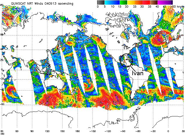
A Scatterometry image from the QuikScat satellite of Hurricane Ivan on September 13th, 2004 shows how Ivan fell into one of the gaps between the satellite's swath. (Courtesy of the Marine Observing Systems Team.)
Still, Scatterometry is very useful with detecting potential tropical cyclones before they develop, as well as getting a sense of wind speeds when the hurricane is out of range of reconnaissance aircraft. This gives Scatterometry an advantage, yet all three types of data have a purpose and are very useful tools.
