


Introduction
The Atlantic hurricane season of 2004 was particularly active with fifteen tropical storms and nine hurricanes, six of which became major hurricanes. One of these major hurricanes was Hurricane Ivan, which reached hurricane status on September 5th, 2004. Over the coming days, Ivan would quickly intensify to become a Category 5 storm by September 9th, 2004.
Ivan’s intensity would fluctuate during the next several days as the storm made a northwesterly track over the Caribbean Sea and into the Gulf of Mexico (see track). As Ivan made its way over the Gulf of Mexico, the hurricane would take a turn to the north, then northeast before coming ashore along the Gulf Coast. Around 2 am CDT on September 16th, 2004, Ivan made landfall in Gulf Shores, Alabama as a Category 3 storm (landfall radar loop; Courtesy of Weather Underground).
From there on, Ivan made its way up the Mid-Atlantic States before drifting out into the Atlantic. The remnants of Ivan made a southwestwardly turn to cross Florida, and then tracked into the Gulf of Mexico once again where it strengthened into a tropical depression. On September 24th, 2004, Ivan made an unusual second landfall in Cameron, Louisiana as a tropical storm.
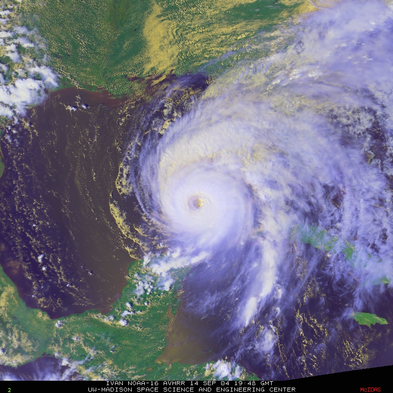
A multispectral satellite image of Hurricane Ivan taken at 1948Z on September 14th, 2004 as it makes its way towards the Gulf Coast. (Courtesy of the Cooperative Institute for Meteorological Satellite Studies/University of Wisconsin-Madison.)
As powerful hurricanes, such as Ivan, develop and intensify, it is important to be able to determine their strength, especially as they make their way towards landfall. Three of the types of data used to help forecast the strength of hurricanes are Vortex Data Messages, Scatterometry, and HRD Wind Analysis.
The point in Ivan’s life that I will be using to help explain these three types of data is around 00Z on September 15th, 2004, when Ivan had weakened to a Category 4 storm. Around this time, Ivan’s eye was located approximately at 24° 33’ N and 86° 56’ W, or to the west-northwest of Cuba. The hurricane was tracking to the north-northwest and had entered the Gulf of Mexico.
