


Introduction
On May 13th, 2009, in the late afternoon, northeast Missouri experienced a significant severe weather outbreak. Powerful supercells developed ahead of an approaching cold front and were responsible for numerous severe weather reports. High winds and large hail were reported over the area as well as several tornadoes that were spawned by a single parent supercell. One of the tornadoes hit the city of Kirksville especially hard.
The tornado that tore through the northern portion of Kirksville ranged from an EF-0 at the first observation of damage and then strengthened to an EF-2. It caused considerable damage to homes and businesses in the area and sadly, two fatalities. The map below shows the track that the tornado took through the city, as well as the strength and damage reports.
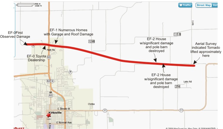
The path the tornado took through Kirksville, MO, including the rating on the Enhanced Fujita Scale and damage reports. (Courtesy of the National Weather Service at Kansas City, MO.)
The set up that day was favorable for strong thunderstorms to develop over the area. Let’s take a look at the synoptic-scale weather pattern that led to this outbreak of severe weather.
